Sagadahoc Stories #83: 3/15/99
Over Here
|
The first Europeans who settled these shores busied themselves
with naming. Putting a moniker on each piece of the howling wilderness
was an attempt to tame it, familiarize it, make it part of the
canon. Bring America into the book of history.
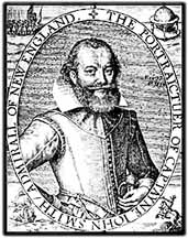
Everyone played the game. When John Smith brought his map of New
England to Prince Charles for approval, His Highness changed half
the names, and Cape Trabigzanda, so called by Smith after the
Turkish lady who saved his skin in Istanbul, became homely Cape
Anne. Fortunately, most of the changes didn't stick, or we'd be
calling the "Kinebeck" Edenborough, the "Aumoughcawgen" Cambridge,
and the "Sagadahok" Leeth. |
The idea of naming New World sites after persons, or places in
the old country, was a curious conceit. A boastful aggrandizement
of man in the landscape, or a pretense of cultural continuity.
But, as is often true with such magic, it worked. Man has totally
dominated this land, and adsorbed America into European history.
| The Indians simply described a place, and those with eyes to see
knew where they meant. The "long flat water" (Kennebec). The "place
where you dry fish" (Androscoggin). "Where the rivers go to the
sea" (Sagadahoc). Such names weren't exclusive to single locales.
Another "Saco-da-hoc" got shortened in translation to Saco. Native
names spoke of a place's true nature, or its passing utility.
There was nothing permanent about a name, and even over the short
period of contact Indian names changed. A "great wood" yielded
to "the corn fields." |
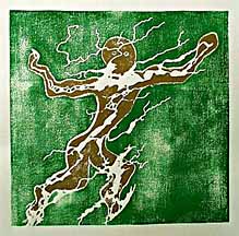
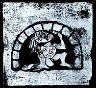
Dancing Man of Sagadahoc
|
Meanwhile the English were staking out turf and disputing over
land patents. From the day in 1607 when the Popham colonists disembarked
on Sir Fernando Gorges' grant at the mouth of this estuary, the
great real estate spec has been going on. The first transplants
on the beach tended to use native terminology, and the braided
waterway which drains this watershed was called the Sagadahoc.
Higher upstream, above Chops, the separate rivers got called by
the first named features encountered by the newcomers. So the
great salmon fishing resort where the Androscoggin falls into
the tidewater in Brunswick, gave its name to the whole river.
"What's that over there?"
"The place you dry fish." And some uncouth syllables get written
on the map. By the ritual act of charting the land, we turned
it from a wild gestalt into linear property to be exclusively
owned. Or attempted to. Having staked it with names meant a bit
of territory could be alienated with a stroke of the pen, too.
The Pilgrims had the first land patent for the Kennebec, which
obviously meant from Bowdoinham to Augusta. But who in England
knew what was in a name? The boys in New Plymouth quickly tried
to expand "Kennebec" to cover all of the Sagadahoc, by redefining
one of the lower waterways as part of that river. Although they
eventually lost the land contest, the naming stuck, and now the
Kennebec runs to Popham.
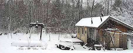
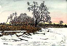
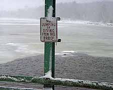
Open water in the bay
|
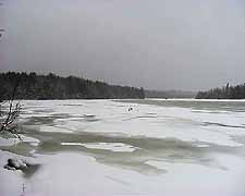
The Kennebec is open its full length now, but ice in the Cathance
is holding fast. It's darkening up as it thins, and looking pretty
punky, but these small tides can't seem to budge it. The last
camps came off over east, one of which is now a pile of mangled
aluminum and pine dragged up by the Abby bridge. CC and I took
another scoot along the flats this week, but it was too slick
to ski happily, and we decided to play in the woods instead.
|
Although the Popham Colony didn't survive the first winter, and
it took the efforts of Vines and Co. at the other Saco-da-hoc
to make the "first permanent settlement" on the Maine, planters
at the mouth of the Kennebec quickly dug in their mattocks. There
had been fishing stations all along this shore for half a century
at least. On Monhegan, Damariscove, Matinicus, the Isles of Shoals,
and also on the mainland at Pemaquid and Popham. All the early
explorers who wrote descriptions of these parts reported on the
many European fishermen drying fish on these rocks. It might have
been Terra Incognita, but it was a well known coast. And the Sagadahoc
was prime turf from the start.
Waves of settlers escaping sectarian authorities in the Mass Bay
soon began running their lines from the lower Kennebec. There
seemed to be some confusion about the place names upcountry, or
maybe that was to keep the fromaways befuddled. For a while the
great freshwater "lake" we call Merrymeeting Bay was called Lake
Somerset. Or Samoset. Whether this was a tribute to Samoset, the
sachem from Pemaquid who was on hand to welcome the Pilgrims at
Plymouth, and was so cordial to planters along the Maine, or the
doing of Christopher Levett, one of the early patented explorers
who was His Majesty's Woodward of Somersetshire, is beyond my
brief scholarship.
| Keeping my nose in a book hasn't helped my attitude this week,
but the weather has been miserably Marching, and the flu persistent.
A big storm swaggered through dumping precip, and then stalled
over Newfoundland. Hadn't had enough fun, apparently, because
the low came back and sat on us for 10 days. Everyone who was
getting over this bug relapsed, and half the town seemed to be
sniveling. The sap run has been on and off. It's a between time.
One of the joys of winter in Maine is the long "Spring." |
Dream of Osiris
(A woodcut poem)
|
By 1673 there were a couple thousand settlers in Maine, and a
healthy proportion of them were fishing, farming, cutting lumber,
and building boats up the Kennebec, from Georgetown and Popham
to Woolich and Bowdoinham. Relations with the Indians were generally
amicable, a lively trade in furs and European goods keeping everyone
happy. Unfortunately there was more culture conflict to the south,
as always. When it boiled over into King Philip's War, even the
quiet planters downeast weren't immune from the bloodshed. The
Indians made a clean sweep, driving the survivors to Biddeford
and Boston, and ultimately unsettling the coast all the way to
York County.
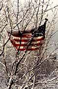
Snow the Flag
|
One hundred years of frontier warfare ensued, only ending with
the fall of Quebec. Fleeting attempts at resettlement along the
Sagadahoc during the French and Indian War came under the torch,
and it was the brink of the Revolution before homesteads began
to dot these shores again. It didn't take long for the newcomers
to start wrangling about names and property lines.
James Bowdoin had been granted rights to that portion of the old
Pilgrim patent which ran from Abigadasset Point (opposite Chops)
to Gardiner, and west to the Androscoggin, which now encompasses
Bowdoinham, Bowdoin, Richmond, Lisbon Falls, and hunks of other
towns. After the early divvying was done, everyone wanted a chunk
of the other guys'. Most of the initial settlement in this burg
was on the banks of the Abby, and along the Kennebec shore north
of Abby Point, and there were soon enough hard cases in situ to
petition the Commonwealth for incorporation. Bowdoinham was, proudly,
the 14th town incorporated in Maine. Incorporating a town meant
you could fight out taxes and turf wars at local meeting. They
immediately started squabbling over the town bounds. |
| Part of the disputed clay was Cathance Neck, this bend in the
river I live on, now locally known as Brooklyn (because we have
a bridge). Both Bowdoinham and Topsham wanted jurisdiction, because
this neck includes some of the scarce deep water frontage on the
bay. It took 50 years to sort out, and when the town line was
finally determined there was a string of shipyards along the river
(a couple hundred ships were built in this backwater in the 19th
Century.. and an uncounted number of scows), and a sizable population
was encamped at Cathance Landing, now the village of Bowdoinham. |
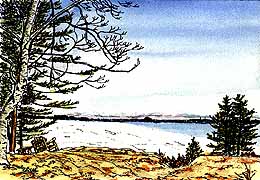
Bodmer on Cathance
|
|
They must have made the first town maps at about this time, because
Abigadasset Point ended up being called Brown's Point, after a
resident on the end of it, and Center's Point ditto. These tributes
to passing homesteaders are still common parlance, and the recent
remapping of road names for 911 has added some of today's residents
to the map. If you want geographic immortality it pays to be there
at the right time, and know someone on the committee. |
My favorite local naming tale may be apocryphal. Seems that a
coasting boat put into the Cathance and tied up at the landing
sometime in the early 1800s, the crew stretching a leg up hill
toward the tavern. One of the local boys who was a bit light-fingered
spotted a big jug of molasses being wastefully unattended on deck,
and decided to see it was properly cared for. He then began to
paddle upriver with it in his canoe (or someone else's). The caper
was spoiled by an untimely return of the crew, who noticed both
the missing jug, and the canoe. They took chase, and were soon
rapidly overhauling the thief. He dodged into the nearest guzzle,
threw the jug overboard, abandoned the canoe, and legged it up
the Fisher Road. The jug sank, but was uncovered at low tide,
and reclaimed. The branch became Molasses Creek. The fact that
it's a slow-moving muddy drain only adds to the flavor.
|
|
|
It's snowing again today, wet and fluffy. But the ground is thawed,
so the plowboys are hesitant to tear up the dooryard, and you
sink into the muck under the snow. I've ordered a dump load of
gravel to fill in the soft spots in the drive, but will have to
wait until Gary gets a break in sugaring, and the snow has melted.
Half the town roads are in collapse. When the frost goes out the
old roads heave and pothole, and the town posts weight limits
to ban through trucking. The Post Road looks like a mine field. |
| All the early transportation went by water, so it took a while
for the back-country to fill up. As it did, short spurs of slashed
road fingered out into the boonies. The Town of Bowdoin petitioned
Bowdoinham to cut a road to their mutual boundary from Cathance
Landing, so the land-locked community could have deepwater access,
but we refused to incur the expense for our neighbors' convenience.
A deal was eventually struck. Bowdoin put up some funds and labor,
Bowdoinham residents along the proposed road donated their taxes
(or labor) to the job, and what is now Rt 125 was hacked out of
the bush east-west. The Old Post Road was the first north-south
road from Brunswick to Augusta, and it still zigs and zags like
a woods trail across Bowdoinham. Probably sits on the same roadbed.
At least it feels like a corduroy road in the Spring. |
|
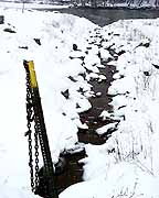
Drain
|
Here's where committees and funding boondoggles come in again.
Some current residents on the Post Road got together and petitioned
the powers to have the road repaired, down to the bedrock. Federal
funding has been acquired. Along with which come engineering guidelines,
which include a wide cleared right-of-way. Now all the old maples
which lined that scenic byway have been leveled. So the commuters
can drive 50 mph in March and not spill their coffee.
We are the improvingest lot. Presently there's a "trails committee"
that was formed to promote the idea of walking trails throughout
town. A nice idea. But there proved to be too much squawking about
private property for that to go far, so the committee, needing
to DO something, is now discussing sidewalks. There are funds
available, of course. Nobody seems to be considering the mandatory
guidelines, however, and how all the shade trees along our village
roads will have to be removed for proper lines-of-sight and setbacks.
|
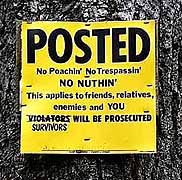
| When you consider how the first planters came here to escape arbitrary
authority and do it their own way, it's curious how eager some
folks are to make new rules and plead for federal assistance.
Of course the better sort always did want to improve the rest
of us, develop the real estate, and put their name on it. |
|